The LiveData tool will update the spatial tables in ArcMap by adding new points, lines, and polygons each time a Work Order or Request is added to the desktop. This helps show you where work is occurring. In order to make the most of the information provided by the LiveData tool, you'll need to tie this data to the Work Orders and Requests system.
Note: Administrators should consult the LiveData Tool topics for information on creating the LiveData Repository, configuring the LiveData tool, updating historical data into the spatial data layers, and archiving data.
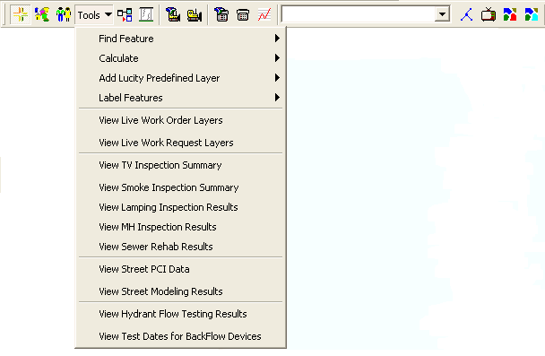
Select Tools > View Live Work Order Layers or View Live Request Layers from the drop-down menu.
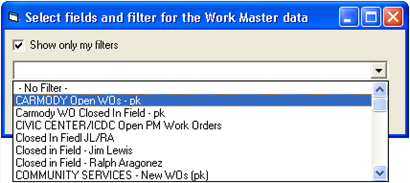
A dialog similar to the following will appear:
You can use this dialog to select a filter from the Work Orders or Work Requests modules. These filters determine which records will be displayed in the map.
If you select "No Filter", all applicable Work Orders or Requests will be displayed.
You can also choose to display all filters or only the ones that you've created.
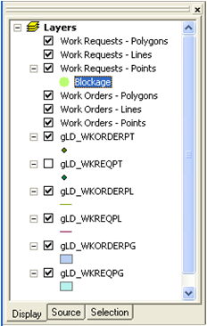
After selecting a filter, new layers will be added to the map. If any layer has data included, you'll see the point, line, or polygon highlighted in the map.
Note: For additional information on how Views are created, follow the link provided.