Labeling with Predefined Labels

The Lucity GIS label tool will label features in the map using a predefined labeling scheme.

  1. To use this tool select Tools > Label Features from the drop-down menu and then select the feature layer you would like to label.

    Tools Drop Down

  2. The following dialog will appear asking for you to select a predefined label scheme.

    Labeling Scheme

  3. Select a labeling scheme and click OK.

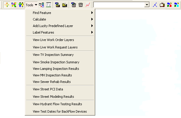
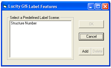
    Note: The Add and Delete buttons are only enabled if the user has administrative rights.

Related Topics:

Setting up Predefined Labels

See Also

Tools Drop-Down Menu

Finding a Feature Based on the Feature ID

Locate Cross Street in Map

Locate Address or Cross Street in Map

Calculate the Total Length/Area

Count Selected Features

View Live Work Order and Request Layers

View TV Inspection Summary

View Smoke Inspection Summary

View Lamping Inspection Results

View MH Inspection Results

View Sewer Rehab Results

View Street PCI Data

View Street Modeling Results

View Hydrant Flow Testing Results

View Test Dates for Backflow Devices