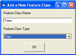
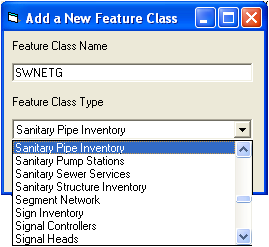
 at the top of the Geodatabase Synchronization Setup Form. The following window will appear:
Notes: SQL Server - If you use SQL Server and your feature classes are loaded into your geodatabase with dbo as the database owner, this field should contain the feature class name only, and should not include dbo.[featureclassname]. If you use SQL Server and your data is loaded into your database as a user other than dbo, this feature class name should be entered in the following format: [owner].[featureclassname]. If you are unsure how your feature class is loaded, go to ArcCatalog, make a connection to your ArcSDE geodatabase, and look at the feature classes listed. They will be listed in ArcCatalog with their fully qualified name. If they are listed as [database].DBO.[featureclassname], then you should only enter the [featureclassname] in this field. If they are listed as [database].[some different user].[featureclassname], then you should enter [some different user].[featureclassname] like it appears in ArcCatalog. ArcCatalog also includes the database name; do not include the database name when entering the feature class name here.
Oracle - If you are using Oracle for your geodatabase, the feature class name should be entered as follows: [SchemaName].[featureclassname], or you should create a public synonym for your feature classes, in which case you can just enter the [featureclassname].
Personal Geodatabases - If you are using personal geodatabases, this should only be the feature class name and should not include any owner or database qualifiers.

- The new feature class will be added to the bottom of the tree located on the left-hand side of the Geodatabase Synchronization Setup form. Click on the feature class and the list of available fields will be displayed in the field mappings grid.
- Scroll through the grid and enter field names in any of the required fields; these fields are colored green. Required fields should not have any value in the Linked Code/Type Field Name column. Update any additional rows with field mappings, and set up the fields at the top of the form, including checking the Primary Update Feature Class checkbox if this is going to be the only or primary feature class that is mapped to this desktop module.
See the Synchronizer Setup and Adding or Removing Fields topics for more information on updating the grid of fields after adding a new feature class.