|
|||
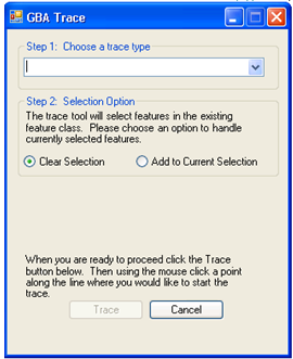
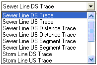
Step 1: Choose a trace type |
Use this drop down to select what type of trace should be performed. |
||
Step 2: Selection Options |
The trace tool selects features during the trace. This option controls how the trace tool will react with any currently selected features. If it is set to Clear Selection it will un-select any currently selected features. If it is set to Add to Current Selection it will add pipes from the trace to the current selection. |
||
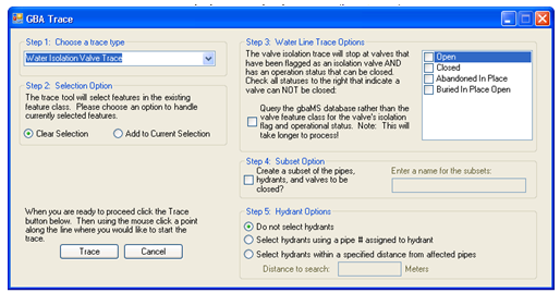
Step 3: Water Line Trace Options |
These options only appear if the Water Isolation Valve Trace is selected in Step 1. This trace decides which valves can be used to shut water off based on whether they are marked as an isolation valve and whether their status is considered "close-able." Use the grid to the right to select any statuses that are not considered close-able. |
||
|
Query the Lucity Database... |
Mark this option if the isolation valve and status information is stored in Lucity instead of the geodatabase. |
|
Step 4: Subset Option |
Mark this box to create subsets of the selected water pipes, valves and hydrants. Enter a name for the subsets in the provided field. |
||
Step 5: Hydrant Options |
This allows users to select whether they want hydrants selected and how. If the third option is selected enter a distance in the provided field. All hydrants within that distance of a selected pipe will be selected as well. |
||
 Perform a Sewer or Storm Trace