|
|||
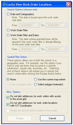
Search Option |
Provides several ways for users to select a set of work orders to display. |
||
|
Date and Category(ies) |
Displays a set of work orders in a date range based on the category selected on the work order. |
|
|
Work Order Filter |
Displays all work orders that are part of a saved Work Order filter. |
|
|
Work Order Filter and Dates |
Displays all work orders that are part of saved Work Order filter, and a selected Date range. |
|
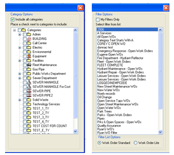
Category Options |
This appears when the Date and Category(ies) option is selected above. It displays a list of categories to check and include. |
||
Spatial Filter Options |
This allows users to filter the results to a selected area. |
||
|
Use the current map extent |
Reduces the results to only show work orders that fall within the current visible area of the map. |
|
|
Select polygon feature(s) |
Allows the user to select a polygon feature after clicking Display. The results are then filtered down to only display work orders that fall within the selected polygon feature. |
|
Misc Options |
These allow users to control the results in several other ways. |
||
|
Do not plot addresses for work orders with assets... |
This option causes the results to not plot the address of the work order if there is an associated asset. If this is turned off the work order will plot both. |
|
|
Do not plot addresses for work work order locations with X/Y Coordinates |
This option causes the results to not plot the address of the work order if there is an X/Y coordinate set. If this is turned off the work order will plot both. |
|
|
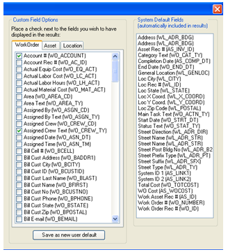
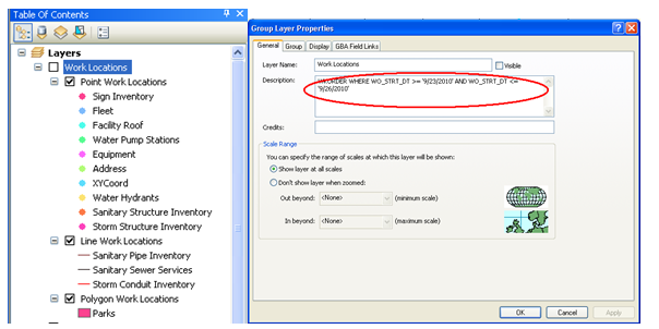
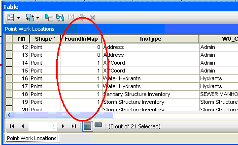
Modify the default fields ... |
The results produced by this tool will plot the location of different work orders and will contain attribute information from the Work Order module in the Attribute table. Check this option to open another section of the tool to change which fields from the Work Order module show up in the Attribute table. |
|
 Plot Work Order Locations