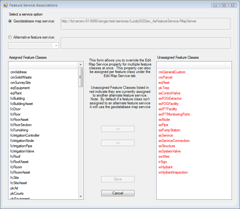
The Update Feature Class Services tool allows administrators to mass configure which Feature Service each feature class uses to push update through. This is normally configured individually on th Edit Map Service tab for each feature class configuration record.

Select a Service Option |
This section allows users to select what service they are assigning to the feature classes they select. |
||
|
Geodatabase map service |
This indicates that you are going to be using the default map/feature service that is set for the entire geodatabase. Since all feature class configurations use this default unless they are assigned an alternative feature service this option is only used to remove an alternative feature service from one or more feature class configurations. |
|
|
Alternative feature service |
This indicates that you want to assign an alternative feature service to one or more feature class configurations.
|
|
Assigned Feature Classes |
This is a list of feature classes that are assigned to the service selected above. |
||
>> << |
These keys move feature class records back and forth between the columns. |
||
Unassigned Feature Classes |
A list of feature classes that are not assigned to the service selected above. The ones marked in Red are assigned to an alternative service. The ones marked in black are not assigned an alternative feature service. |
||
Save |
Saves changes made. |
||
Cancel |
Cancels Any Edits |
||
How to Assign an Alternative Feature Service