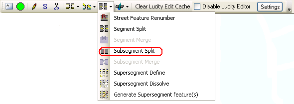
![]() The Lucity GIS Edit tools includes a tool used for splitting street subsegment features in the geodatabase and in the desktop. This tool must be used instead of the ESRI split tool
The Lucity GIS Edit tools includes a tool used for splitting street subsegment features in the geodatabase and in the desktop. This tool must be used instead of the ESRI split tool
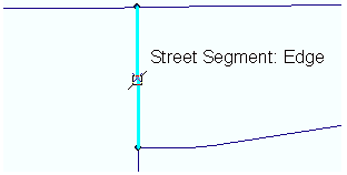
Note: This tool is only enabled if all of the following conditions are met: (1) One feature selected in the map (2) The feature selected is linear.
How To
Split a street subsegment in the map:
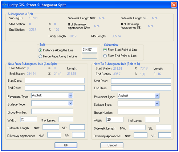
Subsegment to Split: This is read-only information. It lists the information in the desktop for the existing subsegment. Split (Required): This is the calculated distance along the line where the mouse-click occurred. This value can be overwritten.Orientation: This indicates in what direction the split location is measured from.New From Subsegment Info (Optional): These fields will be automatically populated based upon the existing subsegment information. This information can be manually overwritten.Note: The sidewalk length and driveway approach fields are calculated by the system based upon the length of the new subsegment to the original subsegment length.
New To Subsegment Info (Optional): These fields will be automatically populated based upon the existing subsegment information. This information can be manually overwritten.Note: The sidewalk length and driveway approach fields are calculated by the system based upon the length of the new subsegment to the original subsegment length.