![]()
The Redlining tool allows users to add markups to the map. This can be used to provide information to somebody at another location, or to save information for later.
|
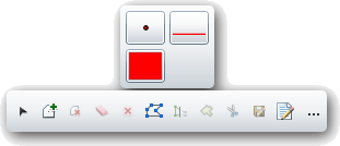
Palette |
A list of all the redline feature classes that are included in the map. They are displayed with a sample of the symbology (the example shows a point, line, and polygon feature class). Select a feature class to begin marking up the map. |
|
New Selection |
Gives the user a selection pointer, allows them draw a selection box in the map, and automatically unselects any previously selected records.. |
|
Add to Selection |
Allows users to draw a selection box in the map. Any selected drawings are added to the current selection. |
|
Remove from Selection |
Allows users to draw a selection box in the map. Any selected drawings are removed from the current selection. |
|
Clear selection |
Unselects all drawings. |
|
Delete selected features |
Deletes any selected drawings |
|
Edit Geometry |
Allows users to click on a drawing and then modify the shape of the drawing. |
|
Save Edits |
Saves any edits made to the drawings. Note: Edits maybe saved automatically based on a system setting. |
|
Display attributes |
Displays the attributes for the currently selected drawing. |
|
Add options |
Expands to show the following options. |
|
Freehand draw |
Allows users to draw free hand. They can click at a spot and the line will begin to draw wherever the mouse pointer goes. |
|
Autocomplete |
Marking this causes polygons to automatically be completed. |
 How To Add Redline Markup to the Map
How To Remove a Markup from the Map