![]()
The measurements tool provides users with a set of tools that allow users to make measurements of Lines, Polygons, and Circles. Users can control the units of measurement too.
![]()
|
Line |
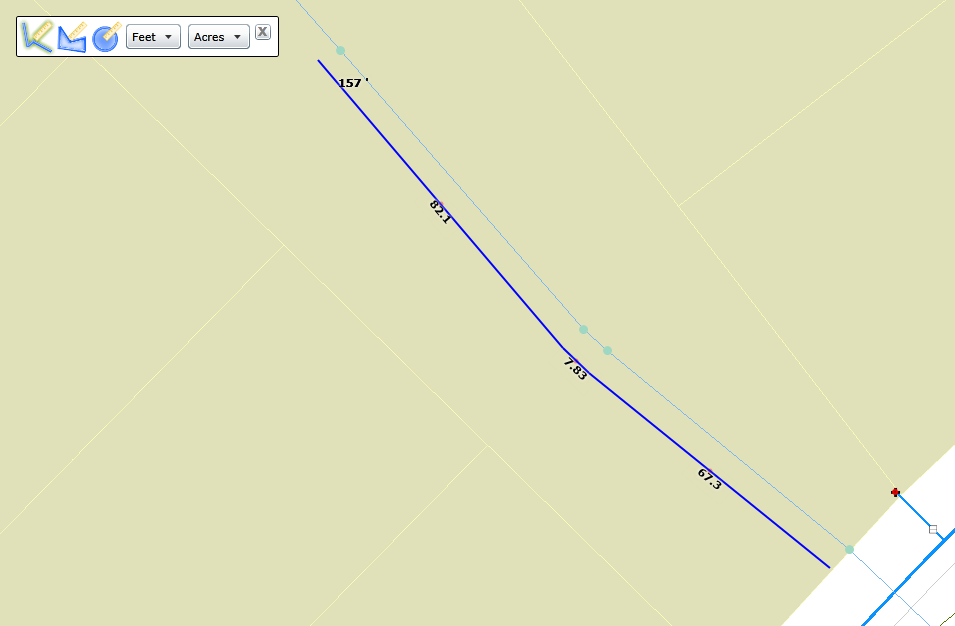
Allows users to draw a line with multiple segments. The tool provides a measurement for each segment and a total for the entire line. |
|
Polygon |
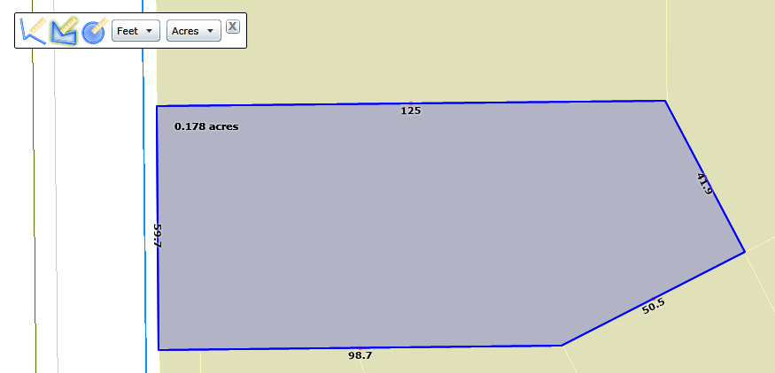
Allows users to draw a polygon. The tool provides a measurement for each line that makes up the polygon and a measurement of the area in the polygon. |
|
Circle |
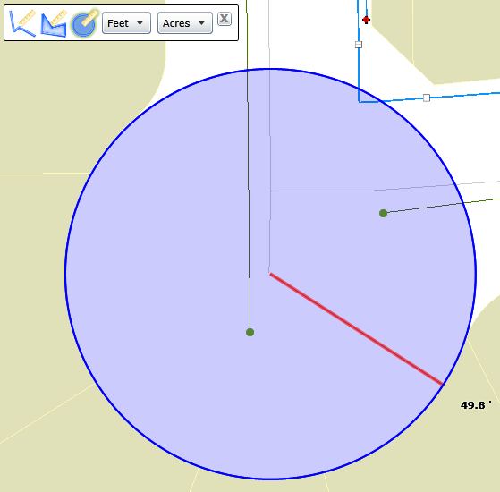
Allows users to draw a circle. The tool provides a measurement for the radius of the circle. |
|
Unit of measurement for lines |
Controls what unit of measurement is used for lines. This includes the lines that make up a polygon, and the radius of the circle. |
|
Unit of measurement for areas |
Controls which unit of measurement is used for area. This is used for the area of a polygon. |
|
Close |
Closes the toolbar. |
How To Use the Measurement tool
![]()


 Line
Line