Default Fields Setup

The Lucity tools found within ArcMap give users the ability to create Work Orders, Requests, PM/Templates and Inspections from the map. When they create one of these a grid is popped up in ArcMap which allows them to fill out critical information before submitting it to Lucity. The fields that show up in these grids are controlled by 3 things:

  1. The field is required by the module. For example, Category is a required field for a Work Order and a work order can't be saved without it.
  2. The field's properties are set to required by the organization. That fields properties have been set to "Required"
  3. The field has been set to display using the Default Fields tool.

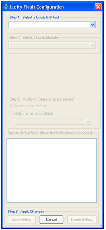
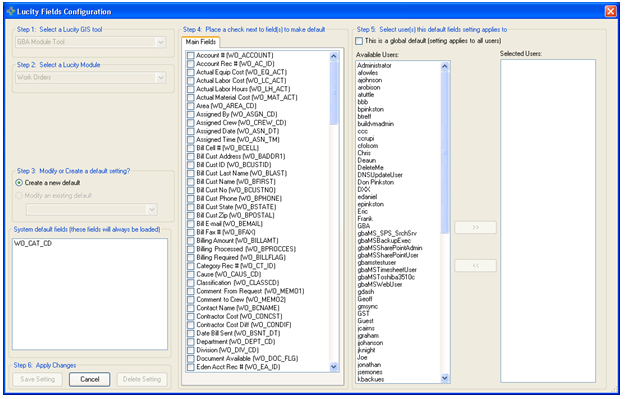
The Default Fields tool allows administrators to setup which fields will show up in the ArcMap grid for a Work Order, Request, PM/Template, or Inspection. They can also control which fields show up, for which users. The fields setup in the Default Fields tool are NOT required and do not have to be filled out.

Click to view image.

Considerations

Which fields do we have to have filled out on a work order, request etc...?

Should this field be set to required or just need to be made available?

Should different people get a different list of fields?

How to

Setup Default Fields

  1. In ArcCatalog, Click on and select Default Fields Setup.
  2. This screen will appear

    Field Configuration

  3. Select a Lucity GIS tool
  4. Select which Lucity Module to setup default fields for.
  5. After selecting the tool and module, the dialog will expand to include the following.

    Field Config_select fields

  6. At the bottom left hand corner is the System Default Fields grid. This is a list of fields required by the program or set as required by the organization. They will always be loaded into the grid in ArcMap.
  7. The center section labeled Main Fields contains a list of all the fields in the module table. Check the fields to include in the grid in ArcMap
  8. The right hand section controls which users these settings will be used for.
  9. To apply these grid settings to all users check the "This is a global default" box.
  10. To apply this to one user (or a set), select the user(s) in the Available Users column and click Select Users to move the user to the Selected Users column.
  11. Click save setting to save the required fields to the module.

    Note: This process can be repeated to set the grid defaults up for other modules.

See Also

ArcCatalog Tools

Geodatabase Configuration tool

Show in Map Configuration

Update Geodatabase Value

Update Show In Map Flag

QA/QC