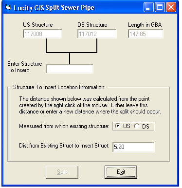
![]() Lucity GIS includes this tool used for splitting sewer features in the geodatabase and in the desktop.
Lucity GIS includes this tool used for splitting sewer features in the geodatabase and in the desktop.
Important: This tool should be used to split sewer features because it protects the integrity of the Lucity database. If you split these features manually, the system will not split inspections, work history, and inventory information to the new feature.
Note: This tool does not split the associated Lamping records. When this tool is run, it reassigns any lampings where the Inspected Structure is the Downstream structure. It doesn't do anything with the Lamping records where the inspected structure is the Upstream structure.
To split two features in the map:

Note: Don't worry if you aren't accurate regarding where to perform the split. You will later be able to enter a length where the split should occur.

The structure number must be unique. You cannot enter a number that already exists in the Lucity database.
Important: Save your edit session. Failure to do so will result in the desktop not getting updated correctly.