The Elevations tab features three sections: Active Elevations, Record Drawing Elevations, and Observation Holes.
Active Elevations
This set of data consists of the active elevations of the pipe segment at the manholes. The purpose of this data is to standardize all references to elevation data. The active elevations and the statuses are all assigned by running the Set Elevations tool (located under Sewer > System Tools). These elevations can be modified if desired. However, to keep the Set Elevations tool from overwriting the manually entered values the the Invert and Elevation locks must be checked.
US Rim |
The rim elevation of the upstream structure. |
DS Rim |
The rim elevation of the downstream structure. |
US Invert |
Flow channel elevation at the structure. |
DS Invert |
Flow channel elevation at the structure. |
Status Fields |
The status of each elevation and the information that determined the active selection. For information on the status codes, refer to the Set Elevations tool help guide. |
Elevation Lock Invert Lock |
Stops the Set Elevations tool from overwriting the value entered into that row of fields. |
Record Drawing Elevations
This section contains record drawing elevation information. These contain the rim and invert elevations as listed on the record drawing. The Set Elevations tool uses the Record Drawing Elevations data to complete the calculation and populate the Active Elevation fields. This tool converts the record drawing elevations to a new datum plane. An example is to change the elevations from a local datum to mean sea level elevations. The Record Drawing fields are described below:

Record US Rim |
The upstream rim elevation listed on the record drawing. |
Adj US Rim Elev |
The adjusted upstream rim elevation. |
Record DS Rim |
The downstream rim elevation listed on the record drawing. |
Adj DS Rim Elev |
The adjusted downstream rim elevation. |
Record US Invert |
The upstream invert elevation listed on the record drawing. |
Adj US Inv Elev |
The adjusted upstream invert elevation. |
Record DS Invert |
The downstream invert elevation listed on the record drawing. |
Adj DS Inv Elev |
The adjusted downstream invert elevation. |
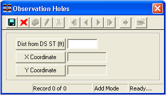
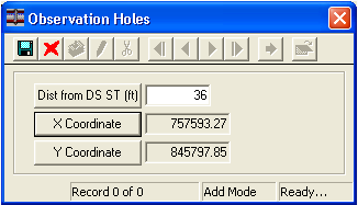
Observation Holes Grid
This tab also contains a grid to track the location of all observation holes for a pipe.
A sample of the grid appears below. Sort records in the grid by clicking on the headings. An up or down arrow (highlighted in orange below) will appear signifying ascending or descending order.
![]()
 How To Add an Observation Hole