Stationing Changes Tab

The Stationing Changes tab allows you to note where a road has either been expanded (for example, when a loop has been placed around a city to lengthen a road) or contracted (when a curve has been straightened out). You can track stationing changes, indicate when the change occurred, and note the changed amount. For each change recorded, the system also calculates a cumulative change.

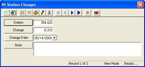
  1. To add a stationing change, right click in the grid and select Add Record. The following window will appear:

    Stationing Change

  2. Record the station and change amount (positive or negative).

    Note: Both of these fields must contain data in order to save the record.

  3. Enter the date the change took place.
  4. Record any additional notes in the field provided.
  5. Save and close the record.
  6. You can then use the functions in the grid to view, edit, or delete the stationing change.

See Also

Roads

Road Header Data

Attributes Tab

Segments Tab

Ramps Tab

Assets Tab

Bridges Tab

ROW 1 Tab

ROW 2 Tab

Traffic Control Devices Tab

Accident Tab

Toolkit

Custom and Comments