![]()
The Print tool allows users to export your current map view into a file format of your choosing.
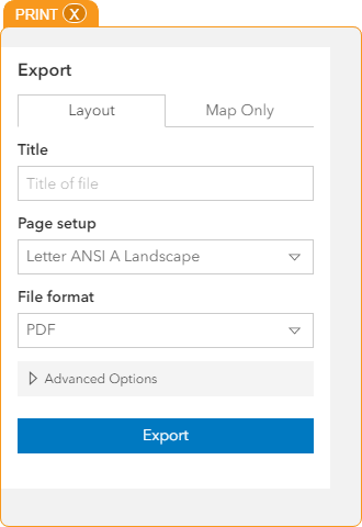
Layout |
|
Exports a view of the map including additional information like Date, Scale, Legend, etc... |
|
Title |
Enter the name you want to name the exported file |
Page setup |
Select the page format. |
File format |
Select the type of file that should be created. |
Advanced Options |
Provides settings for Scale, Author, Copyright, and whether or not to include a legend. |
Map Only |
|
Exports a view of the map. |
|
File Name |
Enter the name of the file |
File Format |
Select the type of file that should be created. |
Width |
Set the map's width. |
Height |
Set the map's height. |
Include attribution |
Controls whether or not the map export displays information about the basemap's source. |
Export |
Exports the map based on the settings selected above. |
 How to Print a Map
 button. The print dialog will open: