The Lucity GIS Edit toolbar includes a Supersegment Define tool used to identify Supersegments in the geodatabase and in Lucity Desktop. This tool can be used to create new Supersegments, to extend an existing Supersegment, to remove from an existing Supersegment, or to redefine an existing Supersegment.
This tool is enabled only when: 1) one or more features are selected in the map, and 2) they are linear.
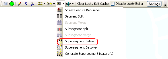
How To Use the Supersegment Define Tool
Start an edit session in ArcMap.
Select a set of Subsegments in the map.
Click the Supersegment Define tool on the Lucity GIS Edit toolbar.
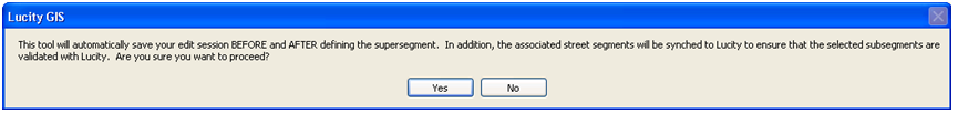
The tool requires the system to save edits before and after it defines the Supersegment. At this time, the Street Segment associated with the selected Subsegment(s) are synced to Lucity Desktop. When prompted (see examples below), click Yes.
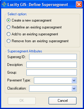
The Define Supersegment form appears:
Choose whether to:
Create a new supersegment (using the selected subsegments).
Complete the Supersegment Attribute fields. (Superseg ID is required.)
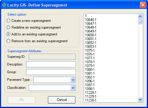
Redefine an existing supersegment (by removing all subsegments and adding the selected subsegments).
The form expands to display all current supersegments.
Select the supersegment to redefine.
Modify the supersegment attributes as needed.
Add (subsegments) to existing supersegment.
The form expands to display all current supersegments.
Select the supersegment to which to add the subsegments.
Modify the supersegment attributes as needed.
Remove (subsegments) from an existing supersegment.
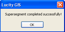
After making all selections, click OK. A message appears when the process is complete.