![]()
The Editing tools allow users to edit feature classes within in the map. They can add new features, edit existing features, and delete features.
Note: Merges, Splits, Renumbers and Deletes must still be done in ArcMap using the special Lucity Editing Tools.
|
Palette |
A list of all the editable feature classes that are currently displayed in the map. They are displayed with a sample of the symbology (the example shows point, and feature classes). Note: If a layer is hidden in the Table of Contents it will not appear in the editing palette. |
|
New Selection |
Gives the user an edit selection pointer, allows them draw a selection box in the map, and automatically unselects any previously selected records.. |
|
Add to Selection |
Allows users to draw a selection box in the map. Any selected features are added to the current edit selection. |
|
Remove from Selection |
Allows users to draw a selection box in the map. Any selected features are removed from the current edit selection. |
|
Clear selection |
Unselects all features. |
|
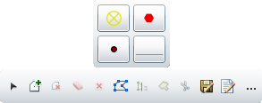
Delete selected features |
Deletes any selected features from Lucity and from the map. |
|
Edit Geometry |
Allows users to click on a feature and then modify the location/shape of the feature. |
|
Save Edits |
Saves any edits made to the features. Note: Edits maybe saved automatically based on a system setting. |
|
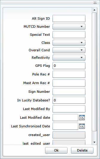
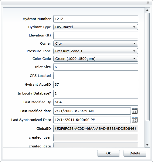
Display attributes |
Allows users to click on a feature and view/edit the attributes. |
|
Add options |
Expands to show the following options. |
|
Freehand draw |
Allows users to draw free hand. They can click at a spot and the line will begin to draw wherever the mouse pointer goes. |
|
Autocomplete |
Marking this causes polygons to automatically be completed. |
Note: After clicking on, and using a tool the cursor will automatically switch back to pan mode. To use a tool again you must click on it again.
 How To Edit a Feature's Location/Shape
How To Edit a Feature's Attributes