|
|
|
|
|
Customer Search Tool
The Customer Search Tool allows you to locate customers in the map based on customer name, phone number, or address. In order to begin using this tool, a system administrator will need to complete the following steps:
- You must have a geocoding service loaded into the application.
- Using the Supporting Services tab in ArcGIS Server Manager, select your geocoding service from the Available Services grid and add it to the Selected Services.
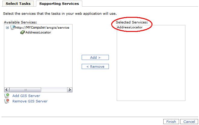
- Using the Supporting Services tab in ArcGIS Server Manager, select your geocoding service from the Available Services grid and add it to the Selected Services.
- After the gbaMS Customer Search tool has been added to the application, you'll need to configure it using the Select Tasks tab.
- Highlight the gbaMS Customer Search task and click Configure. The Task Configuration dialog will appear.
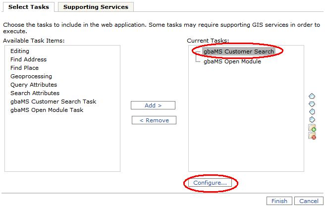
- Highlight the gbaMS Customer Search task and click Configure. The Task Configuration dialog will appear.
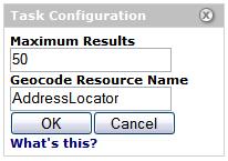
- In the Task Configuration dialog, perform the following:
- Enter the maximum number of results that will be returned when using the task. This step is optional.
- Enter the name of the geocoding resource that you are using. This will be the service that you selected in the Supporting Services tab. This step is required.
- Click OK when you have finished configuring the task.
- Click Finish when your configuration and setup is complete. This task will now be available for use in ArcGIS Server.
See Also |