![]()
The Measurements toolbar provides a set of tools for measuring lines and polygons on the map. When using these tools, users can control the units of measurement.

|
Line |
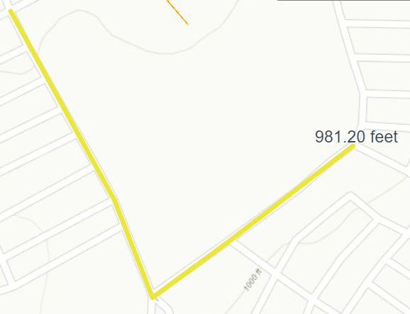
Draws a line with multiple segments. Provides a measurement for each segment as well as a total for the entire line. |
|
Polygon |
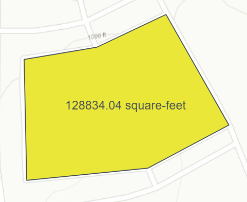
Draws a closed polygon defined by arrays of coordinates. Provides measurements for each line that makes up the polygon as well as the area of the whole polygon. |
|
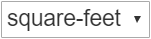
Linear UoM |
Controls the unit of measurement used when measuring lines. |
|
Area UoM |
Controls the unit of measurement used to determine the area of a polygon. |
|
White Font |
Switches the color for the text displayed next to the measurement in the map to white. |
|
Delete Measurements |
Removes all lines and polygons added to the map by the measurement tool. |
|
Close |
Closes the toolbar. |
 How to measure the length of a line
How to measure the area of a polygon
Note: The Measurement tool must be closed before other map drawing tools are opened.


 on the toolbar. The Measurement toolbar appears: