![]() The Street Merge tool will merge two street segments in the geodatabase and in Lucity.
The Street Merge tool will merge two street segments in the geodatabase and in Lucity.
Note: The Street Merge Tool is only enabled if all of the following conditions are met: (1) Two features are selected in the map (2) The features selected are linear. (3) The features are snapped together at one end.
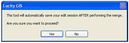
Merge two street segments in the map:
. 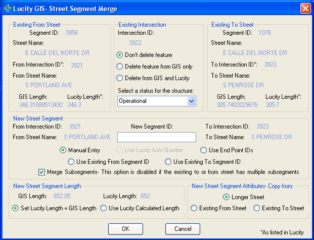
Existing From Street: This is read-only information about the pre-merged from street. Existing Intersection: If an intersection feature was located at the common endpoint of the two street features this section will be enabled. This is the existing intersection information and lists the various merge options for the intersection.Existing To Street: This is read-only information about the pre-merged to street. New Street Segment (required): Users can manually enter a new Segment ID, use a Lucity auto number (this option is only enabled if the segment ID field in the feature class is configured to use a number generator), use the end point IDs, use the existing segment ID of the from street, or use the existing segment ID of the to street.Merge Subsegments: By default, this option is enabled and checked if both of the pre-merged street segments only have one associated subsegment. Leave this option checked to maintain a one to one ratio between street segments and subsegments; otherwise, the newly merged street segment will have two subsegments.New Street Segment Length: This option is only enabled if the tool calculates a difference between the GIS and Lucity street segment lengths. Users can choose to set the Lucity length to be equal to the GIS length or use the Lucity calculated length. New Street Segment Attributes-Copy from: Users can choose to copy over the attributes from the pre-merged from street, pre-merged to street, or the longer street.Note: This option will be automatically set and disabled if the new street segment ID is the same as the previous to or from street segment ID.