
 Print
Print
|
|
|
Observation Holes
- Right click in the grid and select Add Record. The following window will appear:
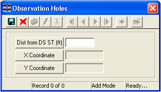
- Enter the distance from the downstream structure (in feet).
- Click
 to save the record. Upon save, the X and Y coordinates will be automatically calculated by the system if both the upstream and downstream manholes have coordinates in the Structure Inventory.
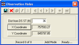
Print
| © Lucity, Inc. All rights reserved. |
|