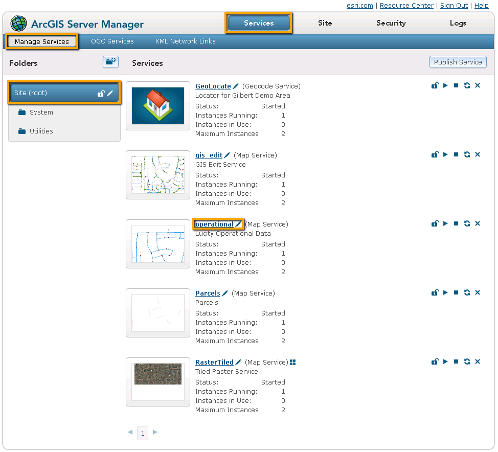
Once the aliases are setup and imported into the geodatabase configuration clients need to publish any maps that they want to use. The Lucity Web map, and Lucity Mobile app support both .mxd, and .msp map services. After the services are published Lucity must be configured to use them.
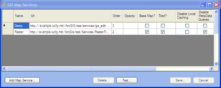
Fill out the order field. (Map services are layered based on this field. A lower number is a lower layer. 0 is the bottom layer)
Check the Base Map? box if this layer is used as a base map.
For more information about configuring base maps go here.
Check the Tiled? box if this layer is a tiled service.
Click Save
Click Test if the map service has Lucity features in it. This will show a list of all the feature classes that the map will recognize as being connected to Lucity.
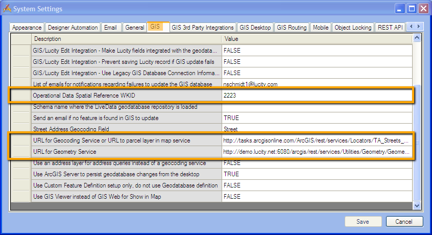
After steps 1 and 2 have been completed for all map services, go within the Lucity Administration Tool to System > Settings > GIS tab.
In the Operational Data Spatial Reference WKID field fill in the Spatial Reference number. This was covered in step 1.h (for Arc 10 setup) or 1.g (for Arc 10.1)
The WKID that is used here must be the the WKID the operational data is referenced against. This spatial reference will be used by lucity to record xy coordinates and any other spatial data.
In the URL for Geocoding Service... provide the URL for what will be the default geocoding service used by the web map or Lucity mobile app.
This can be found the same way that it is found for map services in step 1. Be sure to include the rest/ before the word services in the URL.
It is highly suggested that agencies use a Geometry Service. If they have a geometry service they can include the url in the URL for Geometry Service field. Be sure to include the rest/ before the word services in the URL.
 For Arc 10