![]()
The Measurements toolbar provides a set of tools for measuring lines, polygons, and circles on the map. When using these tools, users can control the units of measurement.
![]()
|
Line |
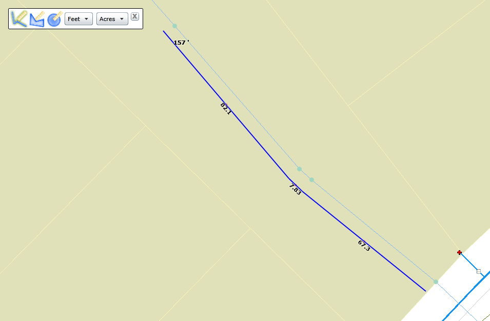
Draws a line with multiple segments. Provides a measurement for each segment as well as a total for the entire line. |
|
Polygon |
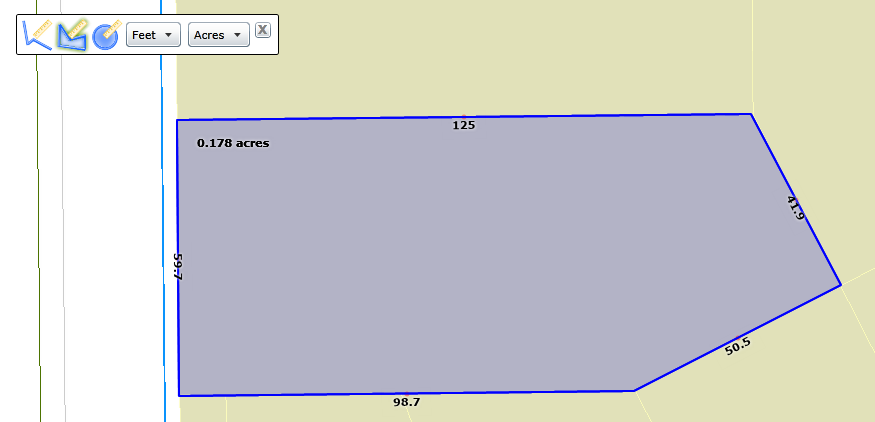
Draws a closed polygon defined by arrays of coordinates. Provides measurements for each line that makes up the polygon as well as the area of the whole polygon. |
|
Circle |
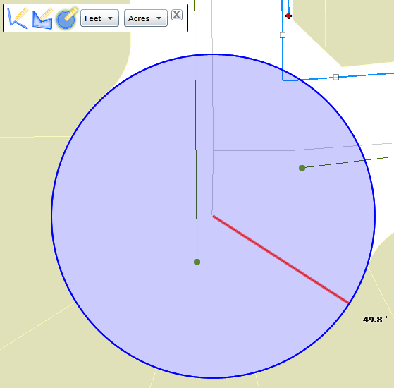
Draws a circle and provides a measurement for the radius of the circle. |
|
Unit of measurement for lines |
Controls the unit of measurement used when drawing lines, including those thatt mak up a polygon and the radius of the circle. |
|
Unit of measurement for areas |
Controls the unit of measurement used to determine the area of a polygon. |
|
Close |
Closes the toolbar. |
How To Use the Measurement Tool


 on the toolbar. The Measurement toolbar appears:
 Line
Line