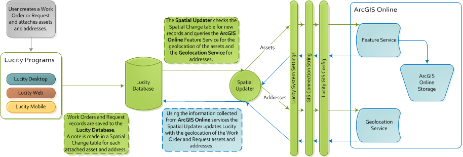
The Lucity Spatial Indexer reviews addresses, coordinates, and assets on Work Orders and Work Requests and stores the related spatial information in a special table. This data can then be viewed using special Lucity GIS tools.
Setup
The Spatial Indexer setup consists of three parts: 1) The general configuration process, 2) the asset configuration process and 3) the address configuration process.
General Configuration
Complete the following steps for each user who will use the Spatial Indexer:
Note: The Spatial Indexer relies on back-end tables added to Lucity in version 7.4. Therefore, the Indexer can only process Work data added after an agency upgraded to version 7.4 or greater.
Asset Configuration
The asset-processing configuration uses the same configuration as the Lucity-to-ArcGIS-Online integration.
Address Configuration
The address configuration uses a geolocation service to process the addresses.
 How to point Lucity to the geolocation service
More information about the service that runs the Spatial Indexer.