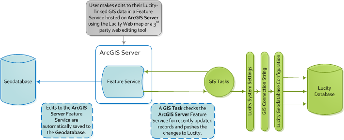
Configuring the Webmap-Editing-to-Lucity integration provides a way to push GIS edits from an editing environment other than ArcMap into Lucity.
Process
Inventory Edits
Edits made in the Webmap are made to a feature service that automatically updates the geodatabase. Such edits are not automatically pushed to Lucity; instead, they must be pushed to the Lucity database using a GIS Task.
The GIS Task runs on a schedule. It checks the feature service for new or updated records, which are then processed and pushed into the Lucity database.
Possible Applications
The process can be used to push data from:
Lucity Webmap > Lucity
Lucity Mobile Map > Lucity
Collector for ArcGIS > Lucity
Any other third-party mapping application > Lucity
Setup
Feature Service
The configuration for the Webmap-Editing-to-Lucity integration uses the same feature service (or alternate feature service) set up to complete theLucity-to-Geodatabase configuration.
Allowing users to edit a feature service also permits them to edit any feature classes in that feature service. Therefore, when configuring Webmap editing, it is typical to use multiple feature services, each containing a set of data. For example, an agency might have a Sewer-feature editing service that contains sewer pipes, structures, and nodes, but omits Storm features. Configuring the services in this way gives administrators flexibility and enables them to provide one set of editable data in one map and a different set in another.
Note that when this method is used, each service should be configured as an Alternate Feature Service.
Create the feature service using ArcMap. Keep in mind:
The map service must contain the feature classes that you want it to update in the geodatabase.
The feature classes must display all of the fields that are configured to link to Lucity.
The map service does not need any additional non-Lucity feature classes.
You can either use a new map service, or an existing one.
The map service does not require any special symbology.
The user account used to add the data to the map service must have edit permissions for the feature classes that Lucity will update in the geodatabase.
The map service must point to the version of the geodatabase that Lucity should update.
If collecting information for the map service that contains your operational data, click on the REST URL. A page containing the properties of the map service appears.
Scroll down and copy down theSpatial ReferenceNumber. (Do this only for the layer that contains Lucity data.)
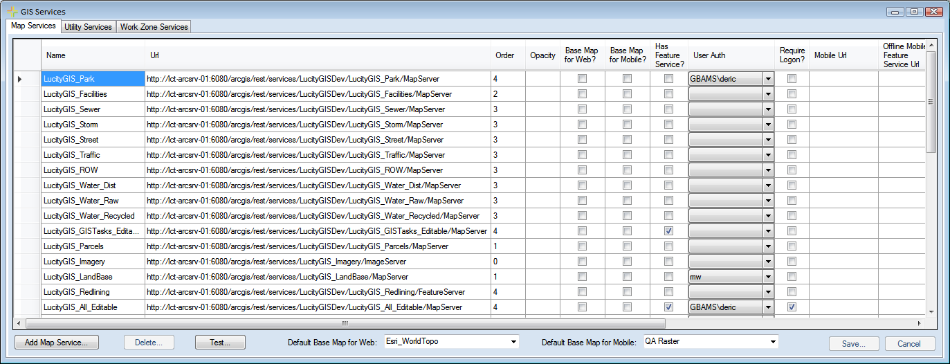
Launch the Lucity Administration Tool and select GIS > GIS Services.
On the Map Services tab click the Add Map Service button.
Enter a Name and the REST URL of the map service.
Note: This URL should end in /MapServer.
Check the Has Feature Service? box. This tells the map that the layer has an attached Feature Service.
Fill out other fields as necessary.
Click the Save button.
Note: If you are modifying an existing map service to have editing capabilities you just need to mark Has Feature Service? box for the existing record in the Map Service setup.
Close the GIS Services tool
Configure the feature class(es) to use an alternative feature service.
Single Feature Class/Single Alternative Feature Service:
Right-click on a configured connection (on the left side of the Geodatabase Configuration tool) and select Update Feature Class Services.
GIS Scheduled Task
The second part of the integration involves creating the GIS Scheduled Task that regularly updates Lucity with new GIS data. GIS Scheduled Tasks are set up in the Geodatabase Configuration tool.
After creating a GIS Scheduled Task for one feature class, an administrator can copy the task and use it for other feature classes that should be synced to Lucity on a similar schedule.
 How to configure an editing feature service