Once a feature class layer is configured it is good idea to check to make sure that there are no problems with link the layer and the module. The validate tool is designed to check the configuration between the feature class layer and the module for errors.
There are several parts to the geodatabase verification. The first is a verification of the geodatabase setup based on Lucity requirements. If no critical errors are encountered during that verification it will continue to the verification.
How To Run a Validation check
Select a feature class layer listed in green in the ArcGIS Online Data section of the tool.
Right-click on the layer and select Validate.
The tool will immediately begin to run the validation and results will be displayed in a validation window.
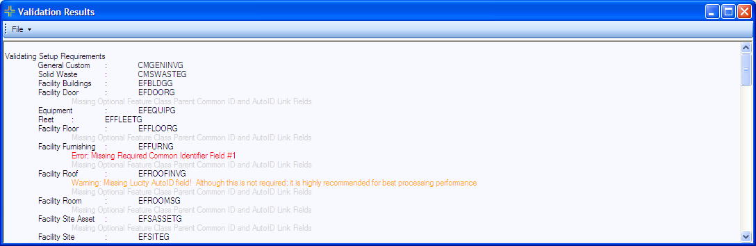
The first part of the validation is checking the setup against Lucity requirements it checks to make sure the Required and Optional linking fields are all filled out.
The results display the Lucity Module name : Feature Class Name. Any messages for a feature class are displayed below.
Suggestions are displayed in Light Gray, Warnings in Orange and Errors in Red.
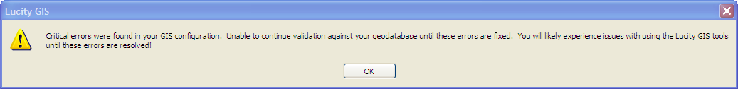
If an Error is detected the Validation will NOT continue to the next part. The following message will be displayed
If the first part of the validation passes the second part of the validation will immediately start and the results will be shown in the same validation window.
The third part verifies that:
The configuration can connect to the Feature Service that the module is configured to work with.
Checks to see if the feature class layer is in the service.
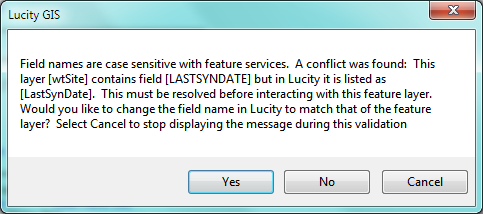
Checks to make sure all the linked fields are in the service.
If it can't find a field it checks to make sure that the field name entered in the geodatabase configuration has the same case as the actual field name. If it finds a field name that is the same but entered with a different case the following prompt will appear:
Click Yes to update the geodatabase configuration with the case-matching field name. This will repeat for any fields that it finds problems with.
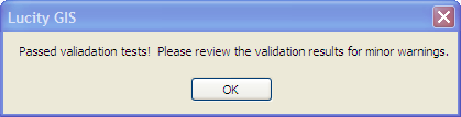
If the Validation Passes the following message will be displayed
After the Validation is complete it can be reviewed. Users can select and copy the results. They can also use the File menu to Print, Save, or Email the Results to Lucity Support.